


Medspiration
The Medspiration Project is a European initiative, funded by ESA (in the frame of DUE program), to combine sea surface temperature (SST) data measured independently by several different satellite systems into a set of data products that represent the best measure of SST, presented in a form that can be assimilated into ocean forecasting models or used for various kinds of application. It has pioneered the implementation of operational services for SST following GHRSST project recommendation and standards.
Medspiration project started in 2004 and has been delivering a full range of innovative products and services for sea surface temperature (SST), in the context of GHRSST framework for which it was the first operational node. Some of these former products are now been natively produced under the umbrella of other agencies (ESA,EUMETSAT,...) or projects (MyOcean) but Medspiration is still improving and delivering new products focusing on the development of high resolution gap-free maps of SST.
What do we provide?
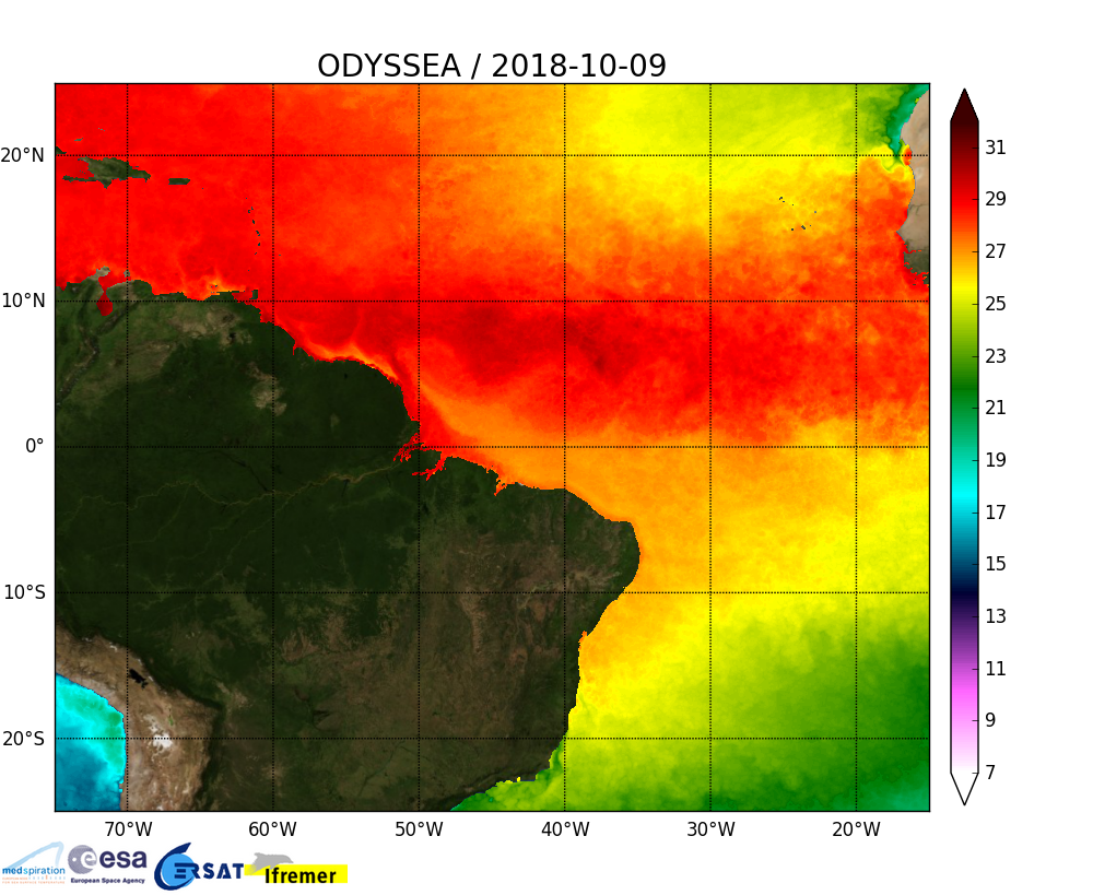
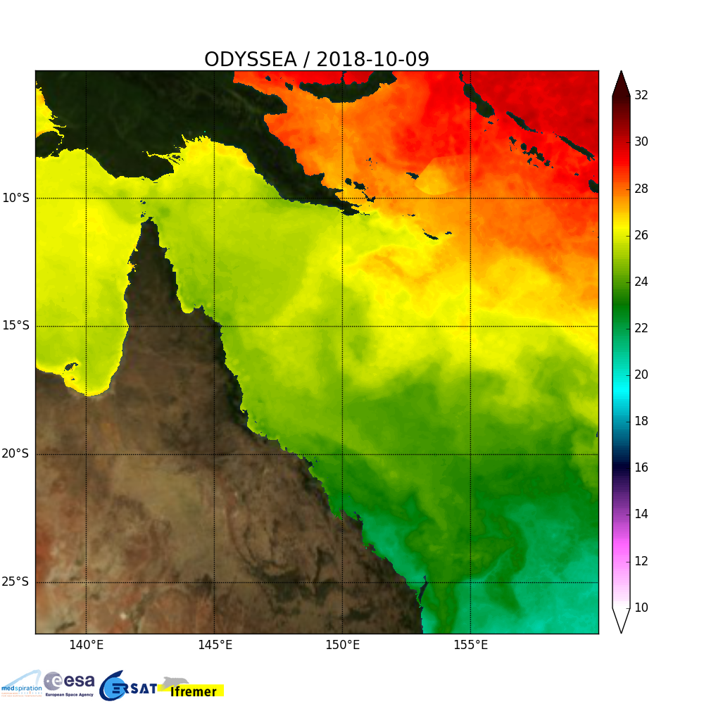
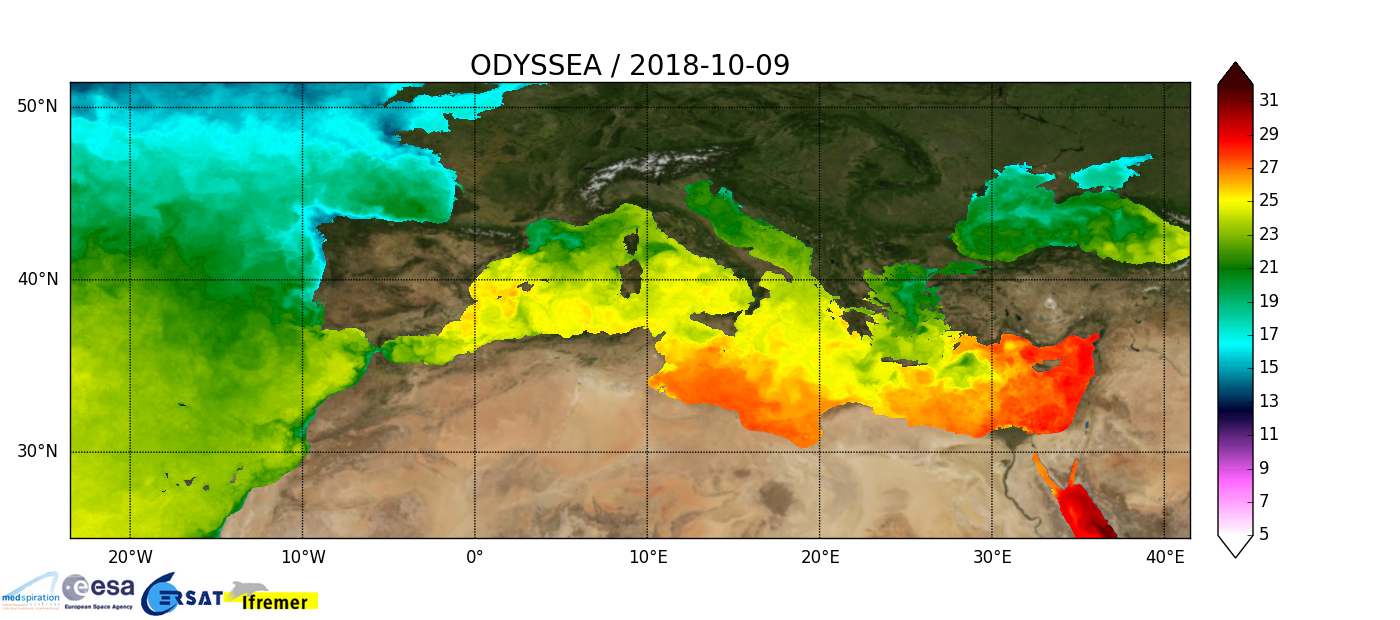
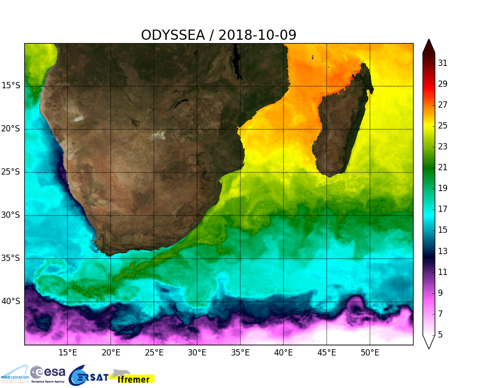
Medspiration is now releasing a new line of high resolution regional SST maps over several predefined areas, such as Mediterranean sea, Brazil, South-Africa and Great Barrier Reef in Australia. This products are now available and updated on a daily basis, and a full reprocessing over Medspiration era (2006 to today) of the Mediterranean sea product has just been completed and will be released soon.
Maps of the day
|
|
|
|
Additional Info
- Web site: Medspiration Project
- Funding agency/program: ESA/DUE
- Duration: 2004-Present
- Status: ongoing


